
GORA TECH

Measure the roads.
Find the way.

GORA surveys the condition of forest roads and develops navigation for motorcycles and bicycles.

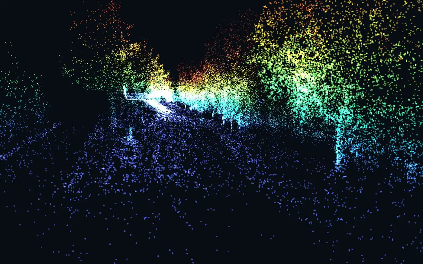
Point cloud: public TIERS dataset, University of Turku, CC BY 4.0 — example data, not recorded by GORA; condition colours for illustration.

From scan to road inventory.

For forest enterprises, municipalities and nature parks we survey the current condition of forest roads and recreational facilities: ridden on a light trail motorcycle, measured with a laser scanner and satellite positioning, delivered as a GIS dataset.

A 142 kg motorcycle, no faster than 30 km/h, weekdays only and only with the forest owner's consent.

> 10 bn
measurement points for a district with 400 km of roads, extrapolated.

Six layers, one dataset.

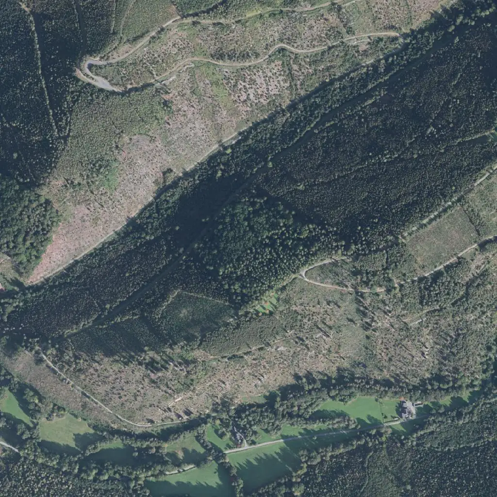
One kilometre of valley slope in the Arnsberg Forest: terrain, aerial image, vegetation and road axes from open state data and OpenStreetMap, aligned in EPSG:25832. On top sits what we measure — condition per section, damage points, facilities.

Terrain (DGM1), aerial image (DOP) and vegetation heights (nDOM): Geobasis NRW, dl-de/zero-2.0 · Roads and facilities: © OpenStreetMap contributors, ODbL · Condition classes and damage points: example. Relief not exaggerated.

  1. 01 · distance 1.67 × network length

    Plan the round

    The network is split into day rounds that cover every road completely — with as little repeated distance as possible.

  2. 02 · ≤ 30 km/h · weekdays

    Ride and scan

    A laser scanner on the rear scans the road crosswise, from ditch to treetop. Dual-frequency satellite positioning keeps the location.

  3. 03 · moving objects: out

    Track and point cloud

    Motion sensor and scanner compute the track. Walkers and cyclists are detected and filtered out.

  4. 04 · clearance 4.0 × 4.2 m

    Cross-sections

    A section every 0.5 m with widths, clearance and pinch points — see the cross-section below.

  5. 05 · photo · coordinate · condition 1–4

    Match the photos

    Benches, huts, barriers and damage are recorded with a photo in the app. Through the shared time stamp every image lands at its place on the road.

  6. 06 · EPSG:25832 · ShapeForst 3.3

    Check and deliver

    Location is checked against your road register and the terrain model; deviations are reported. Delivered for your GIS.

Schematic cross-section of a forest road on a slope with clearance profile and measured values.−4 m−2 mCENTRE+2 m+4 mCLEARANCE 4.00 × 4.20 mCARRIAGEWAY 3.40 mCROWN 4.20 mPINCH POINT · BRANCH AT 3.60 mSCANNERROAD EDGEDOWNHILL SLOPEVERGEDITCHUPHILL SLOPE

← swipe the graphic →

Measured without gaps, evaluated without gaps.

Every point along the road goes into the evaluation. For the measurements the road is split into 0.5 m slices, one after another without a gap. Schematic of a forest road on a slope: carriageway, verge, ditch and both embankments, with the clearance profile above. Every section yields carriageway and crown width, the free passage and every pinch point with its location.

Example values, schematic drawing. Trees: real measurement points from the TIERS dataset, University of Turku (CC BY 4.0). Rider: AI-generated image.

What you get.

The road network in sections by condition (classes 1–4 per KWF leaflet 26), every damage point and every facility as a point with a photo, deviations from the register with their size. As Shapefile, GeoPackage and table. The full point cloud is available separately on request.

We survey and document. Assessment, deadlines and measures stay with the forest owner.

Two directions, related technology.

Surveying on the left, navigation on the right, and in the middle the building blocks both use — each tailored to its task.

Two directions, related technology.Surveying on the left, navigation on the right, and in the middle the building blocks both use — each tailored to its task.NavigationGORA Navigation · ADV · MOTO · BIKERelated technologyfive building blocksMeasure & processroad condition for forestry01Plan the roundcomplete, in day rounds02Ride and scanLiDAR · GNSS L1/L503Evaluate cross-sectionswidth · clearance04Deliver GIS datachecked against register01Pick a profileADV · MOTO · BIKE02Calculate the routesurface · curves · gradient03Guide offlineturns · reroute04Record the ridetrack · elevation · groupRoad networkOpenStreetMap · surface · accessElevation modelgradient · profile · terrainTrack to roadGPS track ↔ road axisRoute engineprofile, not shortest timeOfflinemap and maths on the device

Related technology

  1. Road networkOpenStreetMap · surface · access
  2. Elevation modelgradient · profile · terrain
  3. Track to roadGPS track ↔ road axis
  4. Route engineprofile, not shortest time
  5. Offlinemap and maths on the device

Measure & process

  1. Plan the roundcomplete, in day rounds
    Road networkRoute engine
  2. Ride and scanLiDAR · GNSS L1/L5
    Track to roadOffline
  3. Evaluate cross-sectionswidth · clearance
    Elevation modelTrack to road
  4. Deliver GIS datachecked against register
    Road networkElevation model

Navigation

  1. Pick a profileADV · MOTO · BIKE
    Road network
  2. Calculate the routesurface · curves · gradient
    Road networkElevation modelRoute engine
  3. Guide offlineturns · reroute
    Track to roadOffline
  4. Record the ridetrack · elevation · group
    Elevation modelTrack to road

Why the two belong together. Navigation and road survey rely on the same craft: a road network you can compute with, an elevation model, and GPS tracks matched to the right road. For GORA Navigation this became route calculation. In the survey, the same technology plans the run through a forest district and assigns every measurement to its road section.

Questions about road surveys or GORA Navigation? Write to us and we will get back to you.

Write an email felix@goratech.org